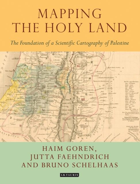
Mapping the Holy Land : The Foundation of a Scientific Cartography of Palestine
Schelhaas, Bruno Faehndrich, Jutta Goren, Haim
Leveringstid: 7-30 dager
Handlinger
Beskrivelse
Omtale
Through a detailed study of the work of three of the leading figures of the era - Augustus Petermann, Physical Geographer Royal to Queen Victoria; cartographer Charles Meredith van de Velde, who produced the finest map of the region at the time; and Edward Robinson, founder of modern Palestinology - the authors explore the complex cultural, cartographic and technical processes that shaped and determined the resulting maps of the region. Making full use of newly discovered archival material, and richly illustrated in both colour and black and white, Mapping the Holy Land is essential reading for cartographers, historical geographers, historians of mapmaking, and for all those with an interest in the Holy Land and the history of Palestine.
-
Utgivelsesdato:
09.05.2017
-
ISBN/Varenr:
9781784534547
-
Språk:
Engelsk
-
Forlag:
I.B. Tauris
-
Innbinding:
Innbundet
-
Fagtema:
Historie og arkeologi
-
Serie:
Tauris Historical Geographical Series
-
Litteraturtype:
Faglitteratur
-
Sider:
208
-
Høyde:
24.8 cm
-
Bredde:
19 cm
Andre bøker i samme serie
Geography and the Classical World : Unearthing Historical Geography's Forgotten Past
Nature Displaced, Nature Displayed : Order and Beauty in Botanical Gardens