Hopp til hovedinnhold

Klikk her for å lese om avvik i bokleveranser og utvikling i nettbutikken

Omslagsbilde

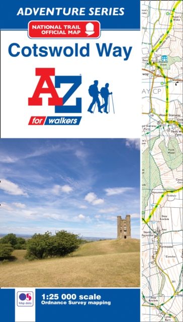
Cotswold Way National Trail Official Map : With Ordnance Survey Mapping

A-Z maps

Midlertidig utsolgt

Leveringstid: 3-10 dager

Handlinger

Beskrivelse

Omtale

The A-Z Adventure Series of maps combines the best of OS and A-Z, creating the perfect companion for walkers, off-road cyclists, horse riders and anyone wishing to explore the great outdoors.The Cotswold Way is a National Trail running along the Cotswold Edge escarpment of the Cotswold Hills. This 102 mile (164km) path begins in the historic City of Bath and finishes in Chipping Campden. Passing through numerous places of interest, the route on the map is clearly highlighted in yellow with mileage markers added to gauge distances when planning sections of the walk to enjoy.This official National Trail Map* of the Cotswold Way features 32 pages of continuous Ordnance Survey 1:25 000 mapping, providing complete coverage of the Cotswold Way. The atlas includes a route planner showing distances between places and the amenities available, featuring:•Information Centres•Hotels/B&Bs•Youth Hostels•Campsites (seasonal opening)•Public Houses•Restaurants•Shops•Cafes (seasonal opening)•Petrol StationsAlso featured is advice on safety and security when walking and a selection of QR codes linked to useful websites, including temporary route updates from the National Trails, regional information, map reading advice and weather reports.Unlike the original OS sheets, this A-Z Adventure Atlas includes a comprehensive index to towns, villages, hamlets and locations, natural features, nature reserves, car parks and youth hostels, making it easy to find the required location quickly. Each index entry has a page reference and a six figure National Grid Reference. With a book size of 240mm x 134mm it is the same size as the standard folded OS map.Other National Trails available within the A-Z Adventure series include: Hadrian's Wall Path, North Downs Way, Offa's Dyke Path, Pembrokeshire Coast Path, Pennine Way, South Downs Way, SW Coast Path, Thames Path and The Ridgeway.*A-Z is the official mapping partner of the National Trails.

  • Utgivelsesdato:

    10.03.2017

  • ISBN/Varenr:

    9781782571698

  • Språk:

    Engelsk

  • Forlag:

    Geographers' A-Z Map Co Ltd

  • Innbinding:

    Heftet

  • Fagtema:

    Livsstil, hobby og fritid

  • Serie:

    A -Z Adventure Series

  • Litteraturtype:

    Faglitteratur

  • Utgave:

    New Second edition

  • Sider:

    48

  • Høyde:

    13.8 cm

  • Bredde:

    24 cm

Coast to Coast : With Ordnance Survey Mapping

Coast to Coast : With Ordnance Survey Mapping

A-Z Maps
9780008727772 Heftet
30.07.2026
Engelsk

Forventes utgitt
Yorkshire Wolds Way : With Ordnance Survey Mapping

Yorkshire Wolds Way : With Ordnance Survey Mapping

A-Z Maps
9780008780548 Heftet
23.04.2026
Engelsk

Forventes utgitt
Hadrian's Wall Path : With Ordnance Survey Mapping

Hadrian's Wall Path : With Ordnance Survey Mapping

A-Z Maps
9780008780531 Heftet
23.04.2026
Engelsk

Forventes utgitt
Lake District Adventure Atlas : With Ordnance Survey Mapping

Lake District Adventure Atlas : With Ordnance Survey Mapping

A-Z Maps
9780008780517 Heftet
12.02.2026
Engelsk

Forventes utgitt
Thames Path : With Ordnance Survey Mapping

Thames Path : With Ordnance Survey Mapping

A-Z Maps
9780008780524 Heftet
12.02.2026
Engelsk

Forventes utgitt
Cotswold Way : With Ordnance Survey Mapping

Cotswold Way : With Ordnance Survey Mapping

A-Z Maps
9780008727758 Heftet
27.03.2025
Engelsk

I salg
South West Coast Path 4 – South Devon : With Ordnance Survey Mapping

South West Coast Path 4 – South Devon : With Ordnance Survey Mapping

A-Z Maps
9780008707644 Heftet
27.03.2025
Engelsk

I salg
South West Coast Path 2 – North Cornwall : With Ordnance Survey Mapping

South West Coast Path 2 – North Cornwall : With Ordnance Survey Mapping

A-Z Maps
9780008707620 Heftet
27.03.2025
Engelsk

I salg
Peddars Way and Norfolk Coast Path : With Ordnance Survey Mapping

Peddars Way and Norfolk Coast Path : With Ordnance Survey Mapping

A-Z Maps
9780008727734 Heftet
27.03.2025
Engelsk

I salg
South West Coast Path 1 – North Devon & Somerset : With Ordnance Survey Mapping

South West Coast Path 1 – North Devon & Somerset : With Ordnance Survey Mapping

A-Z maps
9780008707651 Heftet
27.03.2025
Engelsk

I salg
South West Coast Path 1 – North Devon & Somerset : With Ordnance Survey Mapping

South West Coast Path 1 – North Devon & Somerset : With Ordnance Survey Mapping

A-Z maps
9780008707651 Heftet
27.03.2025
Engelsk

I salg
Great Britain A-Z Road Map

Great Britain A-Z Road Map

A-Z maps
9780008581756
02.02.2023
Engelsk

I salg
London A-Z Street Map

London A-Z Street Map

A-Z maps
9780008581787
02.02.2023
Engelsk

I salg